NHARPC REPORT: RPCs Use SADES Modules to Assist Towns in Assessment of Roadways, Culverts, and Sidewalks
Primary tabs
The information contained in this article is not intended as legal advice and may no longer be accurate due to changes in the law. Consult NHMA's legal services or your municipal attorney.
Road Surface Management System
Local roads are among the largest infrastructure investments for many New Hampshire communities. Road Surface Management System (RSMS) is one module of the Statewide Asset Data Exchange System or SADES. Regional Planning Commissions (RPCs) can work with municipalities to assess and map current pavement conditions and model pavement lifespan/degradation using SADES.

RSMS is a useful tool for cities and towns to plan and budget for maintenance & repairs. Using a statewide standard, the RSMS tool suggests treatments, documents a long-range work plan, and works with the communities to forecast future road conditions and budget for appropriate maintenance of the local road network.
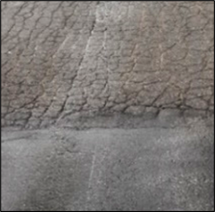
 Good and poor pavement conditions
A typical Department of Public Works (DPW) often debates with town officials whether to defer maintenance of roads due to the high costs or to proactively maintain them. Several New Hampshire RPCs including Central, Lakes, Upper Valley Lake Sunapee, and Southern, have used RSMS to quantify, monitor, and forecast the condition of roads for some of the communities within their regions. A pavement condition index is used to calculate maintenance for each section of a town’s road network. Maps, road prioritization, and projections of road conditions help tailor the most effective paving plan for towns. RPC staff have been invited to present on the RSMS process to several communities in order to help inform community officials and residents on the process used in developing paving plans. Utilizing the RSMS as a tool to educate community officials, many DPWs have adopted a policy of preventative maintenance which has been found to be financially beneficial, saving the community funds in the long run.
Pedestrian Infrastructure Program
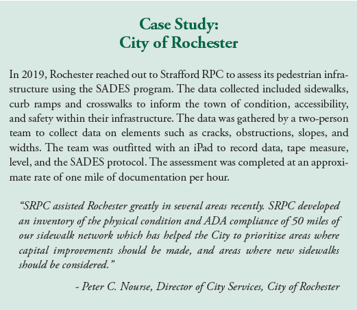
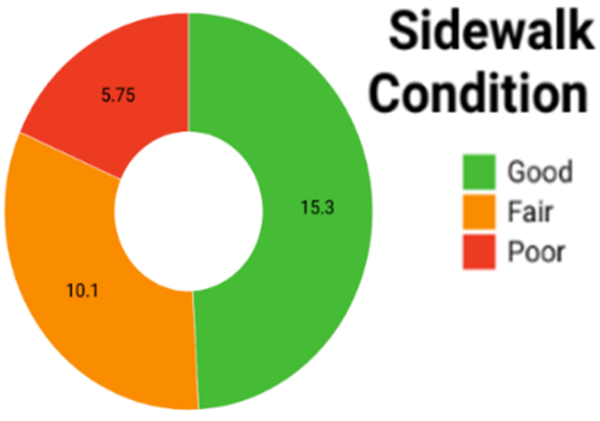
The Pedestrian Infrastructure Assessment is another module of the SADES framework, and includes sidewalks, curb ramps, and crosswalks. These may include analysis of surface material, condition, curbing, obstructions, and accessibility considerations such as width and slope. Inventorying pedestrian infrastructure can help towns target and prioritize improvements for sidewalks given limited infrastructure budgets. The program also helps calculate the overall condition of the pedestrian infrastructure network. In the City of Concord, this program was used for the roads that are scheduled for maintenance in the coming years.
 City of Concord Sidewalk Network Condition (in length of miles)
Stream Crossings Inventory
The Stream Crossings Inventory is the third featured SADES module. The inventory includes structures, such as culverts and bridges, that convey streams under a road. These crossings are a critical component of the road network because instead of driving around the natural systems, they allow vehicles of all sizes to take the shortest routes over streams.
The RPCs work with local municipalities to document the condition and functioning of stream crossings. The fieldwork supports local decision-making and the prioritization of stream crossing for maintenance and replacement projects within a town, watershed, or region. The SADES Stream Crossing Inventory, which began in 2014, holds information on thousands of stream crossings. Inventory data allows NH Department of Environmental Services (NH DES) to run analysis and estimate the risk level of water overtopping the roadway during storm events, degree of aquatic organism passage, and effects on environmental quality. RPCs are able to support local communities in using this data to conduct their own prioritization for stream crossing replacements and maintenance.
 SNHPC James Vayo collecting field data on stream crossings
Through the SADES tools, communities can gain an understanding of where maintenance and improvements are needed. Next steps may include identifying funding sources to help with needed projects from assessment to replacement. Programs such as the Federal Emergency Management’s Hazard Mitigation Grant, the Aquatic Resource Mitigation Fund, the Clean Water State Revolving Fund, or Culvert Flood Risk Assistance are available to help with costs. NH DES regularly offers a free workshop on water infrastructure funding available through NHDES which town staff may want to consider attending if they are seeking additional funding sources: https://www4.des.state.nh.us/infrastructure-funding/?p=312
If you have an interest in learning more about any of the SADES modules, please contact your regional planning commission for more information.
Contributors: James Vayo, AICP, Project Manager, Southern New Hampshire PC jvayo@snhpc.org 603.669.4664 x307; Adam Hlasny, Senior Transportation Planner, Southern New Hampshire PC ahlasny@snhpc.org 603.669.4664 x306; David Jeffers, Regional Planner, Lakes Region Planning Commission, djeffers@lakesrpc.org 603.279.5341; Matthew Baronas, Regional Planner, Central New Hampshire RPC, mbaronas@cnhrpc.org 603.226.6620; Stephen Geis, Planning Technician, Strafford RPC, sgeis@strafford.org 603.994-3500 x112; and Olivia Uyizeye, Senior GIS Analyst/Planner, Upper Valley Lake Sunapee RPC, ouyizeye@uvlsrpc.org 603.448.1680.

